Next: 2.2 Rain Up: 2. Theory Previous: 2. Theory Contents
Wind around a building causes driving rain on the envelope of the building. Without wind there is no driving rain. The atmospheric boundary layer (a.b.l.) is the layer close to the Earth's surface, in which wind is directly influenced by friction with the Earth's surface. Its height ranges from hundreds of metres to a few kilometres and depends on the intensity of thermal mixing (convection), terrain roughness and latitude. The atmospheric surface layer (a.s.l.) is the lowest 10-20% of the a.b.l., where shear is approximately constant with height and production of turbulence is high. The a.s.l. over a uniform flat terrain in a neutral boundary layer is characterised by a wind velocity increasing with height and a wind direction being nearly constant with height.
Due to spatial changes in surface roughness, internal boundary layers (i.b.l.) develop, in which wind speed and direction are modified by the properties of the surface (obstacles), while the top of the i.b.l. flow is the wind velocity adjusted to the terrain conditions before the roughness change. The thickness of the i.b.l. increases downstream of the roughness change.
In the following we will only pay attention to a neutral boundary layer, i.e. an atmospheric situation in which vertical heat transfer is negligible.
The mean wind speed in the a.s.l. as
a function of height is expressed by the so-called ``logarithmic law'':
The friction velocity ![]() is defined by:
is defined by:
| (2.3) |
Displacement height and roughness length are measures for the roughness
of a terrain. A classification of typical ![]() values is presented in
Wieringa ([Wieringa 1992], [Wieringa 1996]).
Some typical values are listed here:
values is presented in
Wieringa ([Wieringa 1992], [Wieringa 1996]).
Some typical values are listed here:
| landscape | |
| 0.0002 | open sea or lake |
| 0.03 | flat terrain with grass, airport runways |
| 0.10 | moderately open country with low vegetation and
occasional obstacles separated by more than 20 obstacle
heights |
| 1.0 | closed and regularly covered terrain; open spaces up to
|
The logarithmic law (eq. 2.1) applies only for:
In the literature one finds several approaches for a relation between wind above two adjacent terrains with different roughness properties. Here, we investigate an abrupt roughness change according to two models. Figure 2.1 sketches the situation. The quantities on the terrain upwind from the change will be denoted by index 1, downwind by index 2.
![\begin{center}%
\psfrag{U1} [Br][Br]{$u_1(z)$}
\psfrag{20ZNUL1}{$20{z_0}_1$}...
...egraphics[width=\linewidth]{h-theory/eps/roughness-change.eps}%
\end{center}](img142.gif) |
Internal boundary layer model
According to the internal boundary layer model described in [Simiu and
Scanlan 1996], it
is suggested that the wind velocity at the top of the i.b.l. (
![]() )
on the second terrain equals the velocity at the same height on the first
terrain.
)
on the second terrain equals the velocity at the same height on the first
terrain.
The height of the i.b.l. at a distance ![]() [m] from the roughness change
is [Simiu and
Scanlan 1996, p. 73]:
[m] from the roughness change
is [Simiu and
Scanlan 1996, p. 73]:
An example is given to calculate the wind speed at a position A at 45 m above
ground level in a town (denoted by ![]() ) with a known wind
speed at 10 m height at a weather station outside the town
(
) with a known wind
speed at 10 m height at a weather station outside the town
(![]() ).
The distance from A to the town border is
).
The distance from A to the town border is ![]() km. The weather station is
on grass covered terrain, so
km. The weather station is
on grass covered terrain, so
![]() m. The roughness of the
town is
m. The roughness of the
town is ![]() m and the displacement height is
m and the displacement height is ![]() m. So,
position A at 45 m height is above
m. So,
position A at 45 m height is above
![]() .
According to equation 2.4,
.
According to equation 2.4,
![]() equals
250 m. The relationship between the mean wind speeds at 10 m and 250 m height
at the weather station is calculated from the logarithmic law:
equals
250 m. The relationship between the mean wind speeds at 10 m and 250 m height
at the weather station is calculated from the logarithmic law:
This yields
![]() .
.
According to the i.b.l. model the wind velocity at A at i.b.l. height
![]() approximates the wind velocity at the weather
station at the same height, so:
approximates the wind velocity at the weather
station at the same height, so:
The wind speed at 45 m height at A is:
Similarity model
The second approach is referred to as the similarity model
[Simiu and
Scanlan 1996, p. 48]; the ratio of friction
velocities is empirically estimated from the ratio of roughness lengths:
| (2.5) |
For the above example, this approach yields
![]() .
.
The present example shows that the two methods yield different
results. The example reflects the site used in the study reported in
this thesis.
Measurements at this site yield
![]() according
to [Geurts 1997] and
according
to [Geurts 1997] and
![]() according to
our own measurements (see section 5.2.1). These values
differ
according to
our own measurements (see section 5.2.1). These values
differ ![]() 20% from each other and the estimations differ to a
similar extent. This is an indication of the error that has to be
taken into account when estimating weather station vs. local wind
speed ratios. (Note that for this example changing
20% from each other and the estimations differ to a
similar extent. This is an indication of the error that has to be
taken into account when estimating weather station vs. local wind
speed ratios. (Note that for this example changing ![]() into
1.5 m and/or
into
1.5 m and/or ![]() into 0.1 m will yield a difference of
3-10% in the estimated ratios.) The ratio
into 0.1 m will yield a difference of
3-10% in the estimated ratios.) The ratio
![]() at our site is discussed in [de Wit
et al. 2002] too.
at our site is discussed in [de Wit
et al. 2002] too.
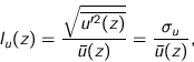
Turbulence in wind causes variation of wind velocity in time and space.
Turbulence is often considered as a superposition of eddies with different sizes
transported by the mean flow. The simplest characterisation of turbulence is by
turbulence intensity, defined as the ratio of the root-mean-square of the
fluctuating component of the longitudinal wind velocity and its time-averaged
value:
 |
(2.6) |
Similarly one defines lateral and vertical turbulent intensities ![]() and
and ![]() , respectively.
, respectively.
The total mean turbulent kinetic energy ![]() (per unit of mass) is
defined as:
(per unit of mass) is
defined as:
| (2.7) |
As shear is approximately constant with height in the a.s.l., the friction
velocity ![]() is also approximately constant. The standard deviation of wind
speed normalised by
is also approximately constant. The standard deviation of wind
speed normalised by ![]() is therefore also a measure of turbulence
in the a.s.l. Typical values, obtained by measurements, are presented in
table 2.1.
is therefore also a measure of turbulence
in the a.s.l. Typical values, obtained by measurements, are presented in
table 2.1.
| [Panofsky and Dutton 1984] | [Geurts 1997] | |
|
|
2.4 | 2.41 |
|
|
1.9 | 1.91 |
|
|
1.25 | 1.37 |
|
|
5.5 |
In the previous subsections we focussed on undisturbed wind. Describing wind patterns nearby buildings and in urban canopies (i.e. beneath the average roof height in towns) is quite difficult because many parameters and especially topography and building geometry are involved. Beranek ([Beranek 1994b], [Beranek 1994a]) and [Bottema 1993b] discuss this topic. We will first discuss the most important characteristics of the flow nearby a free standing building, bearing in mind that these characteristics should be useful for the evaluation of CFD simulations and that for a study on driving rain the lee side of a building is less interesting. Figure 2.2 shows a sketch of the time averaged wind pattern nearby a wide building in the atmospheric boundary layer. Its characteristics are (for more details, see e.g. []p. 80 and further]bottema:1993):
![\includegraphics[height=62mm]{h-theory/eps/bottema.eps}](img186.gif)
|
The complexity of flows in building groups is of course larger than near a single building on an unbuilt plane. Yet three typical flow regimes are distinguished, depending on the ratio of building height and distance between the buildings. Figure 2.3 shows these for a two dimensional configuration.
We use two definitions for the wind velocity vector. The first one, which we will use most frequently, is a globally defined axis system, i.e. relative to north (see figure 2.4):
![\psfrag{U}{$U_x$}
\psfrag{Uh}{$U_{\text{h}}$}
\psfrag{V}{$U_y$}
\psfra...
...
\includegraphics[height=4cm]{h-theory/eps/globalwindaxis.eps}
\end{center}](img189.gif) |
The following quantities are derived from the wind velocity components:
| (2.8) |
| (2.9) |
The second definition is related to the mean wind direction:
© 2002 Fabien J.R. van Mook
![\includegraphics[height=47mm]{h-theory/eps/beranek.eps}](img180.gif)